


FGCU students harness technology to study hurricane impacts, coastal habitats


Florida Gulf Coast University students are using technology for several projects designed to help Southwest Florida community partners manage challenges in coastal areas, ranging from hurricane-related beach erosion to the impact of boat propellers on vulnerable aquatic habitats.
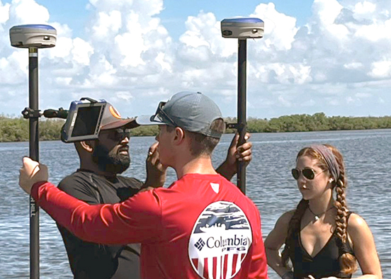
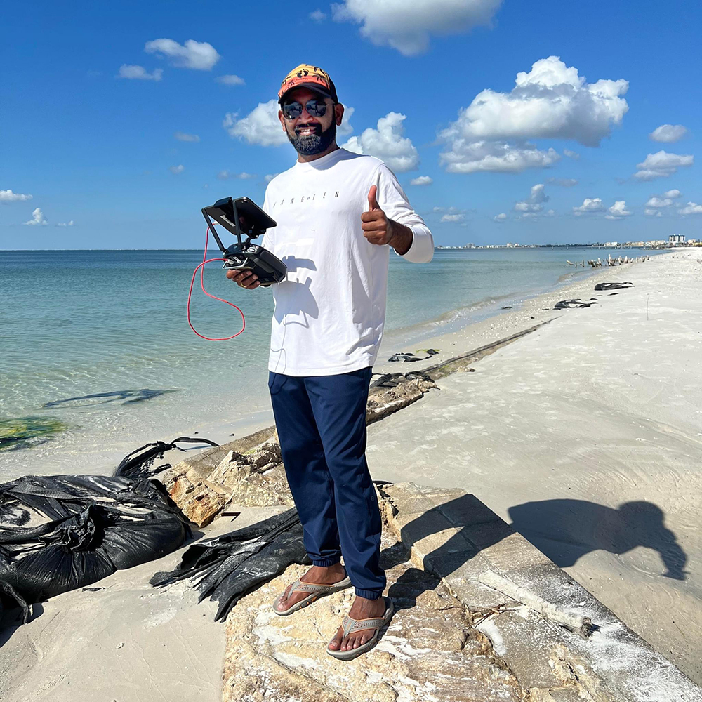
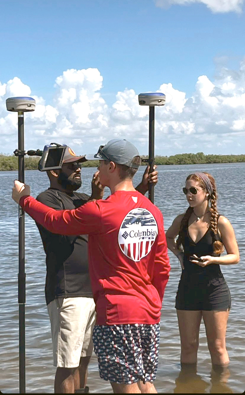
Guided by Dhruvkumar Bhatt, an instructor in The Water School, the students are gaining hands-on experience with geographic information systems (GIS), remote sensing technology and airborne drones. Using these tools to collect location data, they are working on understanding coastal problems as a way to enhance decision making in fields such as coastal and aquatic habitat management.
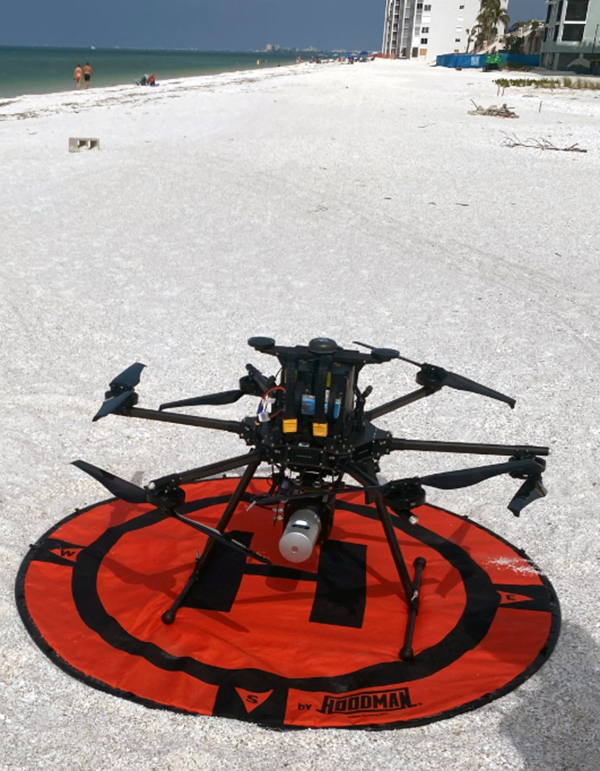
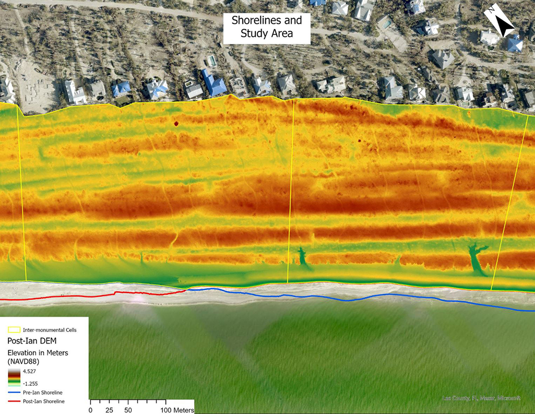
Since Hurricane Ian hit Florida in September 2022, Bhatt and about a dozen students have been mapping local coastlines using high-resolution airborne light detection and ranging (LiDAR) to gather data on beach erosion caused by storms.
“Major storms like Hurricane Ian can have a significant impact on the coastline by moving beach sands in high amounts through storm surge and wind,” Bhatt said. “Using technological advancements such as LiDAR sensors on board a drone, we can measure erosion and deposition of sands on the beaches from drone flights conducted before and after a storm event.”
The assessments help local governments develop budgets for beach renourishment and assess preparedness for future storms, he said. The FGCU team has collaborated with Lee County, the cities of Sanibel and Naples and other communities in Southwest Florida.
Invaluable research experience
Nathan Hewitt, a 2024 FGCU graduate with degrees in marine science and environmental studies, was part of the group working on the hurricane impact assessment.
“My role was to analyze digital elevation models (DEMs) generated from LiDAR sensors,” said Hewitt. “The LiDAR sensors we were flying were drone-based, and we were able to capture the damage done to our beaches by Hurricane Ian. We would then compare our post-Ian DEMs to DEMs collected before the storm to observe areas of erosion and deposition across our beaches.”
Participating in the research was an invaluable experience that helped convince Hewitt to pursue graduate school, he said. The Indiana native is now working on his master’s in environmental science at FGCU.
“Attending conferences and events where we could showcase our work and networking with environmental and GIS professionals influenced my decision heavily,” Hewitt said. “I was also able to apply what I learned through the research in several classes, which enhanced my learning experience.”
His current research focuses on employing remote sensing tools to monitor the health of vegetation at dune restoration sites.
Studying the impact of propellers
In another project, FGCU students utilized high-resolution aerial images of the Estero Bay Aquatic Preserve to assess the impact of boat propellers on sensitive ecosystems and vegetation such as seagrass, which provides food and habitat for several marine species.
“Estero Bay can experience heavy boat traffic during peak tourist season, which can cause the propellers to leave a ‘scar’ in a seagrass bed within No Internal Combustion Motor Zones,” Bhatt said.
“Prop scars are often talked about in relation to seagrass beds, but scarring also affects oysters, mudflats and other habitats. Using geospatial technology, we can streamline the process of identifying and delineating areas of concern season after season and assess the need for seagrass protection areas in No Internal Combustion Motor Zones.”
The Estero Bay project enabled Grace Markell, a 2024 FGCU graduate with a bachelor’s degree in marine science, to participate in NASA Develop, a national 10-week research initiative. The project used NASA data to help solve environmental and public policy problems.
“I worked on quantifying damage within No Internal Combustion Motor Zones over the past three decades to provide valuable data on how this specific form of seagrass damage has changed over time,” said Markell, who now leads a team of interns during her second term with NASA Develop.
“This project developed my knowledge of GIS, which strengthened my work with NASA Develop,” the New Smyrna Beach native said.
“It gave me confidence in the hard skills I learned in my FGCU classes, like using GIS software or coding, preparing me for the workforce. I also learned a lot about project management and collaboration, which are skills that have surprised me in their value as a young professional.”
Mapping protected species habitat
In another ongoing project, faculty and students are using satellite imagery to assess the impact of development on protected species such as the gopher tortoise in Lee County. Bhatt mentored environmental studies major Katherine Luttrell, who worked with the East Lee Wildlife Stewardship Group on the research, which won a first-place award at last spring’s Eagle X student showcase.
“This project will help future developers understand where gopher tortoises are likely to be present,” Bhatt said.
“It also informs decision-makers on where there could be a possibility of gopher tortoise burrows to enforce stricter laws for rehabilitation of the species.”
As a whole, the research conducted by FGCU students and faculty is paying dividends to the Southwest Florida region that the university calls home, he said.
“These projects are focused on understanding water-related issues such as storm surges, flooding, water quality and much more and how to make our community more resilient and sustainable to the ever-changing environment,” Bhatt said.
“They align with The Water School’s mission by advancing environmental sustainability, resilience and community-focused research. Together, these projects exemplify the school’s commitment to innovative science and real-world impact.”
Latest FGCU News
- FGCU grads stepping up amid school counselor shortagesThe first four students to graduate from medical school through Florida Gulf Coast University’s pre-health professional program partnership with Lake Erie College of Osteopathic Medicine (LECOM) are...
- From internship to career to mentor, alum at Arthrex comes full circleEmily might be in Paris on Netflix, but a new internship opportunity unique to Florida Gulf Coast University enabled two...
- $800,000 gift honors longtime friend and fan of FGCUDaniel Schroeder might be the ultimate Southwest Florida resident. Born and raised in the area, he is a Florida Gulf Coast University alum with...
- Students get hands-on healthcare experiences on a global scaleThe first four students to graduate from medical school through Florida Gulf Coast University’s pre-health professional program partnership with Lake Erie College of Osteopathic Medicine (LECOM) are...
- Cincinnati Reds pick Eagle pitcher in MLB draftWhenever Raina Harmon considered moving on from her assistant coaching job at the University of Iowa, she compared other schools...
- First graduates of FGCU partnership with medical school embark upon residenciesThe Naples Botanical Garden celebrated the grand opening of its Evenstad Horticulture Campus in 2024. Described by Brian Galligan, vice...